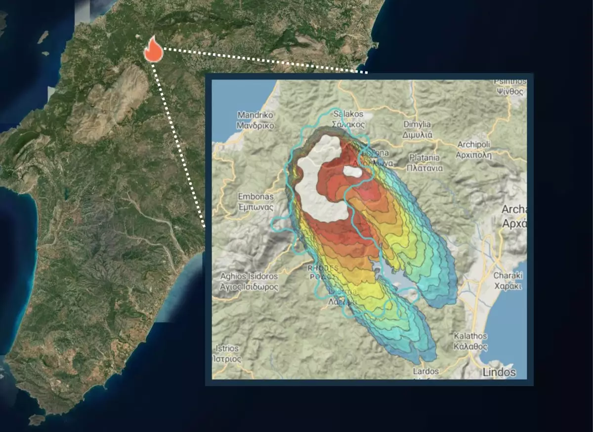
As climate change accelerates, wildfires have become increasingly common, wreaking havoc across ecosystems and human settlements. The challenge of managing these forest fires has pushed researchers and entrepreneurs to explore innovative solutions. Among the most promising of these is the application of advanced satellite technology to improve wildfire detection and tracking. Companies like OroraTech are at the forefront of this effort, utilizing a unique approach that combines space-based surveillance with cutting-edge data analytics.
OroraTech, a German startup, is enhancing our capacity for wildfire management by developing thermal-infrared imaging satellites. Their pioneering technology offers the potential for near-real-time monitoring of forests, enabling rapid response to fire outbreaks. The company’s current constellation includes two active satellites, but their ambitious plans aim to expand this fleet to eight by mid-2025. By covering vast areas—160 million hectares of forest land—they aim to provide crucial information that can save lives and property.
Securing Funding for Future Growth
To fuel this expansion, OroraTech recently raised €25 million ($27 million) in a Series B funding round. This capital will be pivotal in scaling their operations and enhancing their predictive capabilities, ultimately allowing for better preparedness against wildfires. The funding round was supported by various investment entities, demonstrating significant confidence in OroraTech’s vision and potential impact. As the company has struck a deal with the European Space Agency (ESA) to monitor forests in Greece, it underscores the growing recognition of the importance of their monitoring capabilities.
At the heart of OroraTech’s strategy is data collection. Initially, they relied on information from a network of existing satellite sources and terrestrial sensors, but the shift to deploying their own satellites marks a turning point in their operations. With each satellite launched, the volume and quality of data collected increases exponentially. This robust dataset not only enhances the predictive accuracy of their artificial intelligence systems but also contributes significantly to improving the overall service they provide.
The Future of Wildfire Monitoring
Looking ahead, the impending launch of their next satellite, named FOREST-3, scheduled for early 2025, represents a crucial step in establishing a comprehensive surveillance network. The investment in advanced technology for wildfire detection could set a new standard in ecological monitoring. Moreover, collaborating with major tech companies like Google further indicates that the potential value of their data-driven services is gaining traction in broader tech and environmental circles.
As wildfires continue to pose significant threats worldwide, innovative companies like OroraTech are blazing a trail toward smarter, more proactive management solutions. By leveraging satellite technology and sophisticated data analytics, they aim to enhance our ability to predict and respond to wildfire risks effectively, setting a precedent for sustainable intervention in an era marked by environmental unpredictability.

